Sonoran Desert Landscapes
photos from the McDowell Sonoran Preserve - Hike to Tom’s Thumb from Scottsdale, AZ
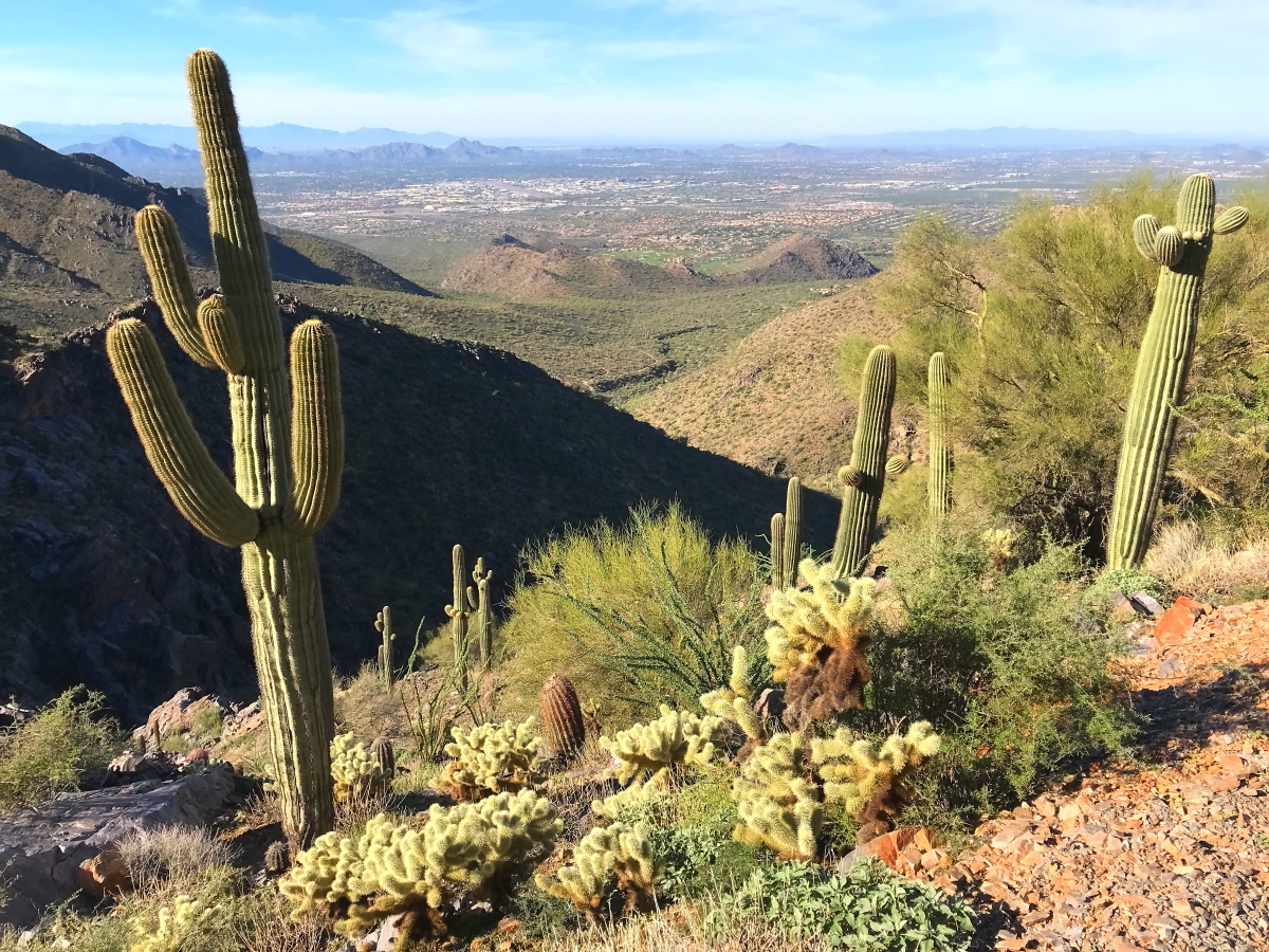
View of Scottsdale, AZ from Tom’s Thumb South Trail. Chola cacti, palo verde, barrel cacti, and saguaro cacti in the foreground. Typical Sonoran desert.
Is this Post for You?
A handsome formation of saguaro cacti, stately sentinels in the wilderness, on a fairly steep slope among outcrops of bare rock with fractured facets and sharp edges, providing a palette of form for landscape composition
Are you a landscape or nature photographer looking for superb desert vistas? This post is for you. It will introduce you to a secret little corner of the Sonoran desert, the McDowell Sonoran Preserve. The preserve provides a fine example of Sonoran desert wilderness that’s within easy access of a major metropolitan airport – the Phoenix Sky Harbor (PHX). Read on and visit the galleries on this site (Bodies of Work Galleries – Sonoran Desert). I look forward to your comments and critique.
Are you in the market for framed prints of epic desert scenery for your home or workspace? Then I invite you to scan this article and visit the galleries here. You’ll find artwork whose aesthetic appeal is timeless and inspirational. I’m sure you’ll love the landscape photography featuring the Sonoran desert. Also note that I offer framed prints and canvas wrap prints of my landscape photography.
Whether you’re a landscape photographer or in the market for framed prints, this post is for you.
The Main draw of the McDowell Sonoran Preserve is its Abundance of Cacti
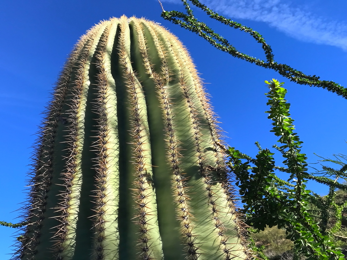
A saguaro cactus next to the thorny stems of the ocotillo plant
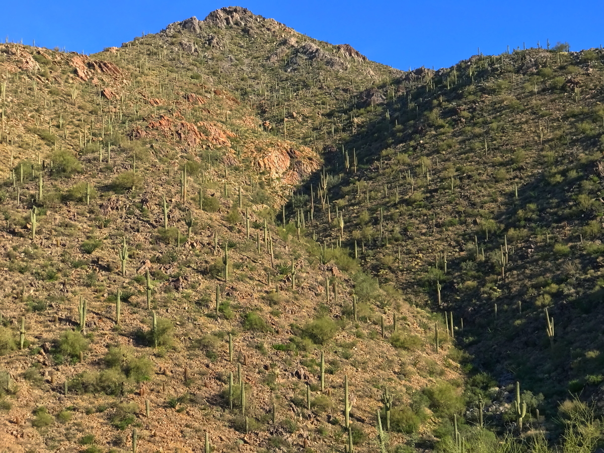
I suspect the saguaro cacti draws both landscape and nature photographers to the preserve. It grows in abundance at lower elevations, from the flat valley floor up to the summits of the mid-sized hills, two or three thousand feet high, but not up to the highest peaks in the preserve, well above three thousand feet.
Hiking through the preserve, you’ll find countless opportunities to compose landscape photos featuring the saguaro cacti.
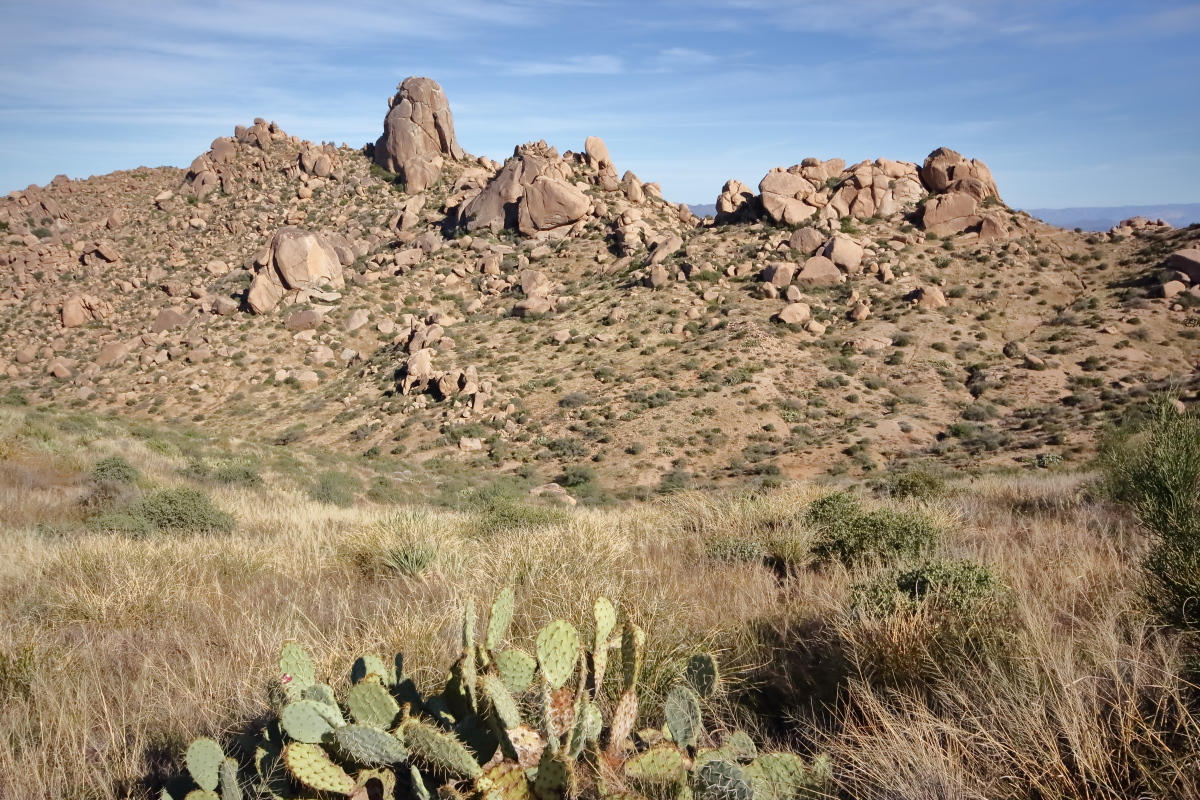
You’ll find a rich diversity of desert flora that you can use as foreground elements of interest in your composition. Don’t overlook all the species of cholla cacti, including the photogenic teddy bear cactus. When these catch the light, they seem to glow with an incandescent halo.
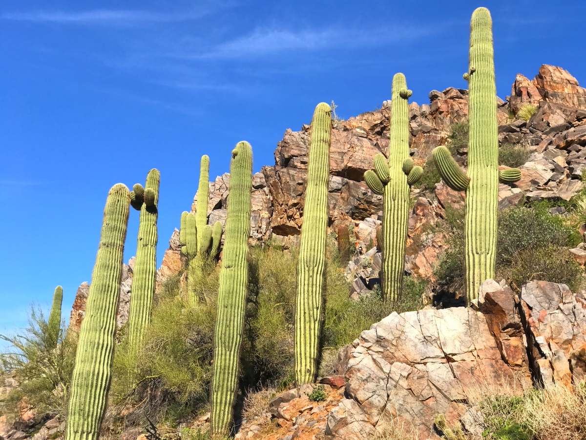
Saguaro cacti are abundant on the steep lower slopes of the McDowell Sonoran Preserve
The Desert Flora Changes as you Gain Elevation
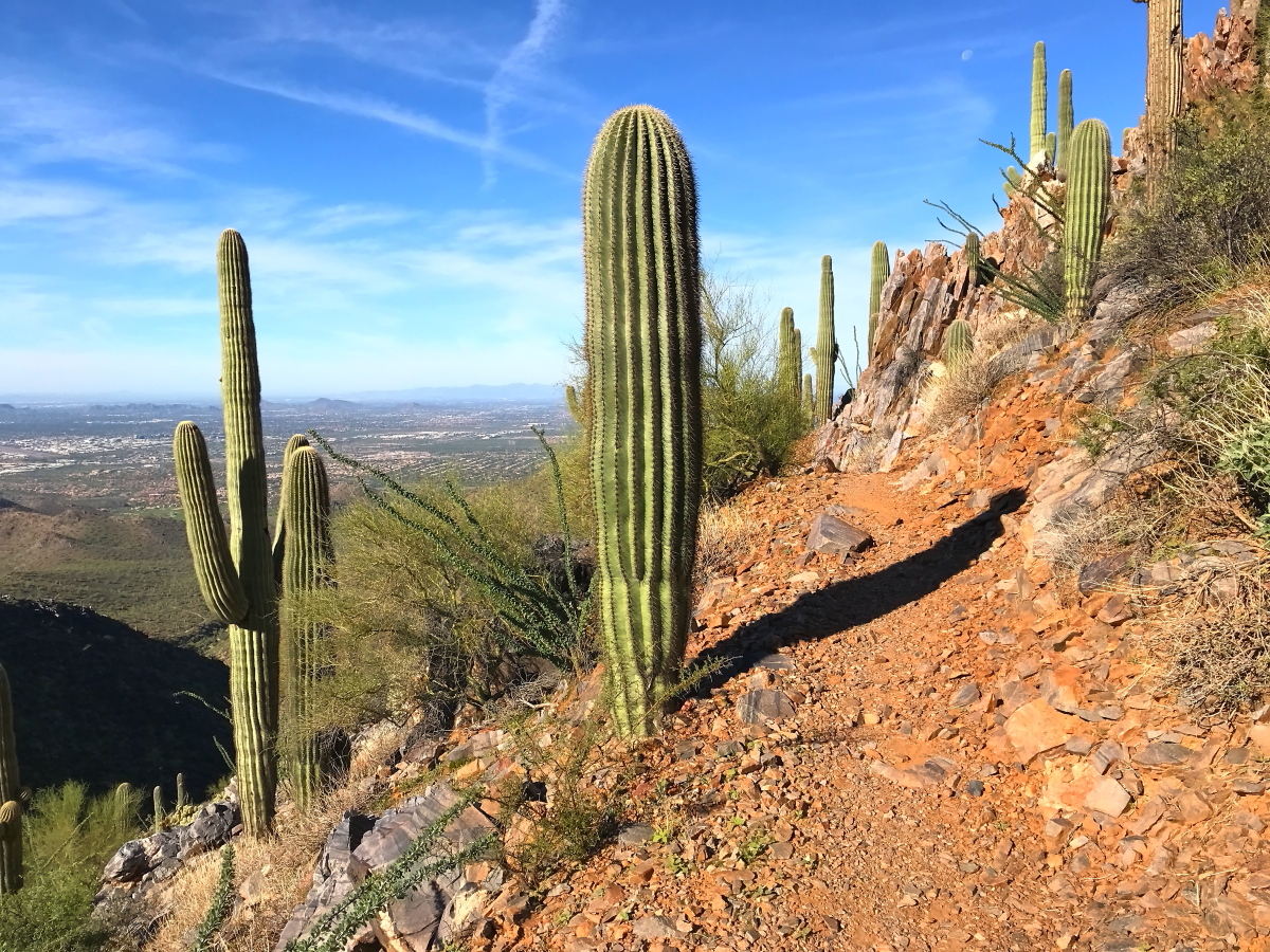
Single column and branched saguaro cacti stand next to the trail. The view to the West from the switchbacks on the South Tom’s Thumb Trail. Scottsdale lies on the distant, flat valley floor.
At higher elevations, the saguaros give way to pincushion cacti and barrel cacti with its short, spiral column. Among these you’ll find ocotillo, palo verde, several species of acacia, including mesquite, all growing among several species of agave.
When you climb the switch back trails well past three thousand feet, you’ll leave the saguaro cacti behind, along with ocotillo and most species of chollo. Instead, cold hardy species thrive at higher elevations, with tall grass growing thick around isolated clumps of prickly pear cacti.
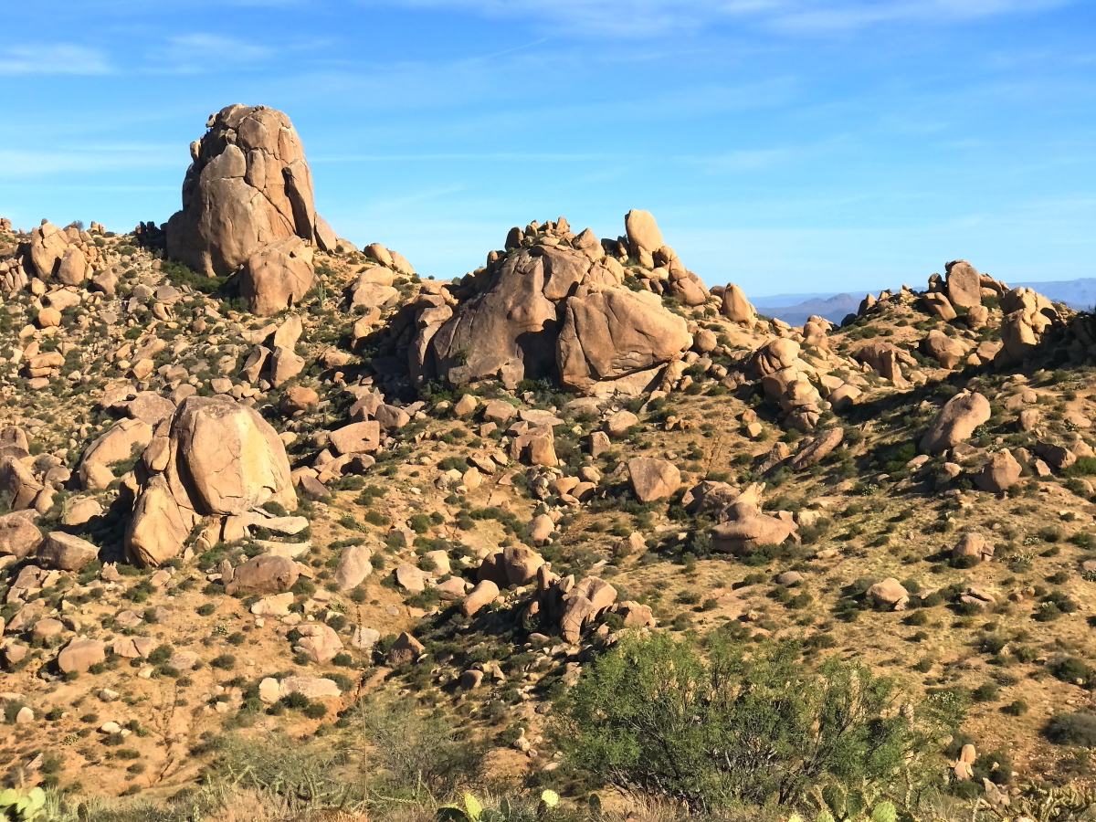
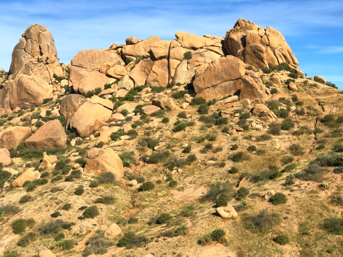
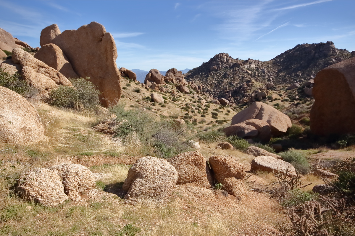
The Summits of the McDowell Range are crested with Epic Granite Boulders
The highest summits of the McDowell Range are devoid of saguaro cacti. Instead, you’ll find stands of prickly pear cacti, and stunted cholla cacti. Otherwise, grassland dominates the summit, with a few clumps of mezquite, creosote bush, and palo verde.
Both the landscape and the desert flora transform as you reach the summit. Sharp, angular faces of oxidized rock give way to massive granite boulders with rounded edges. These boulders dominate the ridge tops and the summits. Many look as though they’ve been stacked into monumental structures, forming bridges and passageways. They remind me of Egyptian ruins.
You’re sure to find epic vistas for your photo compositions among the boulders.
Benefits of the McDowell Sonoran Preserve
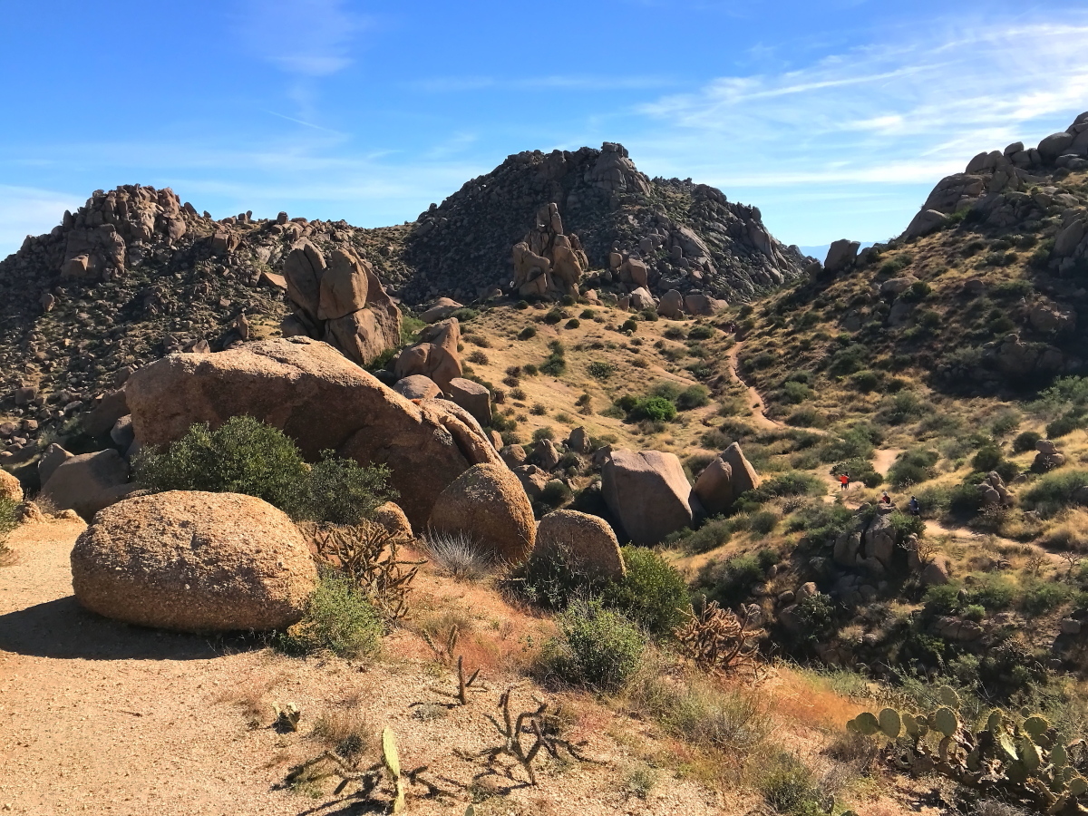
Boulder formations along the approach to Tom’s Thumb. Tom’s Thumb, a granite tor, upper left.
The McDowell Sonoran Preserve offers a few key advantages to landscape and nature photographers.
It’s highly accessible, only a short drive through Scottsdale from the Phoenix Sky Harbor (PHX), a major North American transportation hub.
In Scottsdale, AZ, only a few city blocks from the main trailhead, you’ll find restaurants, hotels, resorts, Airbnb properties, and all the trappings of modern civilization.
The main trailhead itself features clean toilets, drinking water and lots of parking space.
You’ll also find your perfect level of hiking difficulty in the preserve, which features an extensive and well maintained network of trails, ranging from boardwalk strolls to grueling ascents up to the McDowell Range, for sunrise to sunset expeditions.
The preserve lies en route to several world class destinations in Arizona for landscape photography. Two hours north will bring you to the red rock wilderness of Sedona, AZ. Three hours beyond Sedona brings you to the Grand Canyon.
The preserve offers you an escape into a remarkably untouched and unspoiled corner of the Sonoran desert ecosystem.
The land is carpeted with the iconic desert flora of the deserts of the Wild West. You’ll find diminutive cholla and stately saguaro cacti, palo verde and prickly pear. You can also expect remarkable blooms of desert wildflowers from mid-March through late April.
The rugged terrain is photogenic in itself. The terrain features narrow, vee shaped valleys with steep walls and massive, bare rock faces under sharp, angular Peaks.
It’s a dramatic landscape of steep-sided valleys strewn with epic boulders and sculptured rocks, all interspersed with epic cacti and desert flora.
The McDowell Sonoran Desert Preserve is a magical world
The hiking trail can be seen where the horizon meets the right-hand edge of the photo – a ribbon of bare sand. The trail wends its way around the feet of epic granite boulders.
The McDowell Sonoran Desert Preserve is a magical world replete with scenic vistas of desert beauty where you can capture landscape photographs that evoke a sense of inspiration and adventure, redolent of the Wild West.
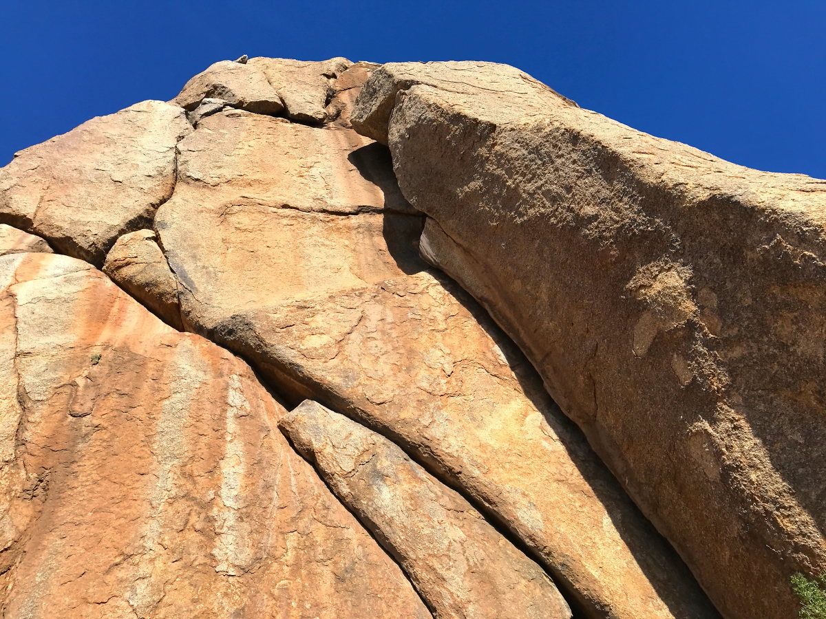
Looking up from the base of Tom’s Thumb.
Geographic Location - The Sonoran Desert
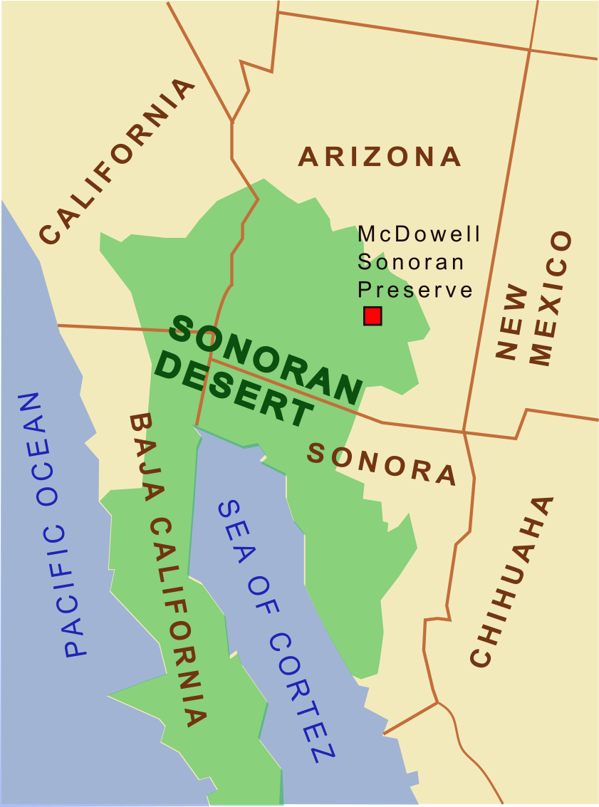
Map showing the location of the Sonoran Desert
The Sonoran Desert extends into the Mexican states of Sonora, Baja California Norte, and Baja California Sur, wrapping around the Sea of Cortez. It spills north into the U.S. states of California and Arizona.
In Arizona, the Sonoran Desert spreads over the southwest corner of Arizona, primarily covering low-lying land of up to about 2,000 feet.
But the desert also contains several mountain ranges that rise up to 4000 feet or more. The McDowel Range is one of them.
The Sonoran Desert is the only desert in North America that lacks a cold winter. Instead, its climate has three distinct seasons, an extremely hot, dry season, and two distinct wet seasons. One results from winter rains, while the other results from monsoon rains in the summer. The monsoon rains are driven by a climatic effect created over the Gulf of Mexico.
Lacking a cold winter gives the Sonoran Desert its unique ecosystem. Unlike the Mojave and Chihuahuan deserts with their vast expanses of sagebrush, mezquite and yucca, the Sonoran desert is home to gigantic saguaro and cardon cacti (giant Mexican cacti), as well as the California fan palm.
The McDowell Sonoran Preserve covers a tiny area of the vast Sonoran Desert. The preserve lies a short distance northeast of Phoenix, Arizona.
How to Get to the McDowell Sonoran Preserve
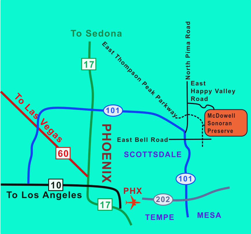
Map showing routes from PHX to the McDowell Sonoran Preserve
It’s a short drive from the Phoenix International Airport to the South and North entrances of the preserve.
To reach both entrances, follow route 202 east from PHX, then travel north on route 101.
For the South entrance, exit right from route 101 onto East Bell Road then turn left onto Thompson Peak Parkway. After a half mile, turn right into the trailhead parking complex. You’ll find washrooms and a drinking water fountain here.
To reach the North entrance, exit right from route 101 onto the North Pima Road. After four miles, turn right onto the East Happy Valley Road. Follow this road east then turn right onto East Ranch Gate Road. Turn right again onto North 128th Street and drive to the end of the street. You’ll pass through a traffic circle then veer left into the parking area for the Tom’s Thumb Trailhead. You’ll find a latrine here but NO DRINKING WATER.
In general, the trails in the preserve lead through narrow, steep sided valleys and then up switchbacks to summits and ridges.
The preserve is home to a short range of mountains, the McDowell Range, which rises up from the flat valley floor at 1800 feet up to 4000 foot peaks.
I’ve only hiked into the preserve from the south trailhead. My longest hike took me from there up to Tom’s Thumb Trail and onward to Tom’s Thumb, a prominent granite tor atop the ridgeline. The total distance, there and back, was a 13 Mile return hike. I saw lots of epic scenery along the way.
Recently I stumbled upon the Alltrails app, and found a much quicker route up to the Tom’s Thumb Summit. Definitely download the Alltrails app if you plan to hike up to Tom’s Thumb and photograph it in the morning golden hour.
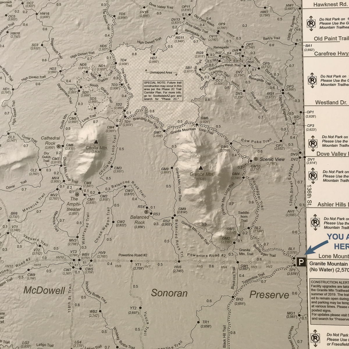
My Story of Doom in the McDowell Sonoran Preserve
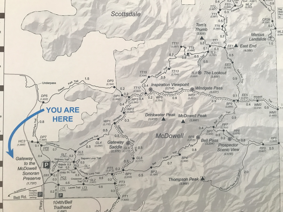
Trail Map for the southern part of the McDowell Sonoran Preserve
My first hike to Tom’s Thumb was an accident.
I had planned a short hike of two or three hours to cover six miles up to Inspiration Point and back. But I missed the trail junction and kept hiking until I found myself at Tom’s Thumb. Instead of a short jaunt, I ended up hiking 13 miles through the desert, a journey one does not embark on lightly, even early in the day. It became a long hard slog. I became dangerously dehydrated. You should not attempt this hike without an adequate supply of water, at least a gallon per hiker.
I suspect that the North Trail offers all of the benefits to landscape photographers that the South Trail offers, while covering only one-third of the overall distance. For that reason, I recommend hiking to Tom’s Thumb from the north trailhead at least for your first visit to the preserve. It’s a far shorter distance to carry both your photography gear and all the water you’ll need to stay hydrated in the hot desert.
Again, I recommend you download the Alltrails app. Here’s the link.
Along either route, you’re going to encounter vast expanses of bare rock and sandy soil, with miles upon miles of well maintained trails, whose surface is generally hard packed sand and gravel. At lower elevations the trails are fairly level but eventually ascend steep switchbacks up to the ridgelines and summits. You’ll see rocky bluffs and angular rock faces, with their surfaces oxidized into a gamut of bronze through warm burnt umber. Amongst the rocks are patches of light sandy soil that support rich desert flora.
What to Bring - Basics of Desert Hiking in the McDowell Sonoran Preserve
Map showing wilderness trails north of the McDowell Sonoran Preserve
It’s essential to bring a map, a gallon of water and sun protection. Your sun protection should include sunglasses, a wide brimmed hat and SPF 50 sunscreen for all of your exposed skin. Trail running shoes are optimal. Local recommend that you hike the preserve in the cool early morning. Winter months are cooler. I recommend pre-dawn hiking with an LED headlamp to catch the golden hour at your chosen vista.
The primary consideration is hydration. You’ll need to carry a water bladder with a four liter or one gallon capacity, or light backpack with at least four, 1 liter bottles of water. Each hiker in your party should carry at least a gallon of water. Avoid sugary drinks.
You’ll also need navigation aids if you’re not familiar with the terrain. I recommend a map and a GPS device. Don’t rely on cellular coverage.
What to Bring to the McDowell Sonoran Preserve for Landscape Photography
Boulder Garden south of Tom’s Thumb at the McDowell Sonoran Preserve
Bring a sturdy, lightweight tripod, camera and your favorite prime lens, along with spare battery and memory card, UV filter, polarizing filter. Also pack your phone camera or ruggedized adventure camera, and a compact video action cam for trailside snapshots and vlog material.
I must emphasize bringing a tripod for longer exposures for golden hour, blue hour, twilight and astrophotography, and for capturing bracketed exposures for HDR reconstruction, and parallax free, overlapping frames for panoramas.
Also bring a UV filter, a polarizing filter and a lens hood to capture clear and vibrant details free from glare and haze. You’ll also want to darken the sky and suppress reflected light off the lush greenery.
I recommend bringing your favorite prime lens to capture all the gorgeous detail in your landscape photo as clearly as possible.
Phone cameras and pocket cameras are great for capturing quick images you can use for planning future landscapes projects. After all, you can’t hope to capture all of the beauty and all of the scenic splendor of the preserve on a single day hike.
Note on the photos in this Post from the McDowell Sonoran Preserve
Tom’s Thumb Ridge Bestselling Photo by Doug Weir available at Outdoor Studio at Redbubble
I shot all the images on this post using my Canon T4i, Canon 20D, or iPhone 7 plus. I processed the images using Canon’s Digital Professional Photographer software, version 4. Please visit my galleries on this site for higher resolution versions of these images.
About the Blogger for DWP - Doug Weir Photo
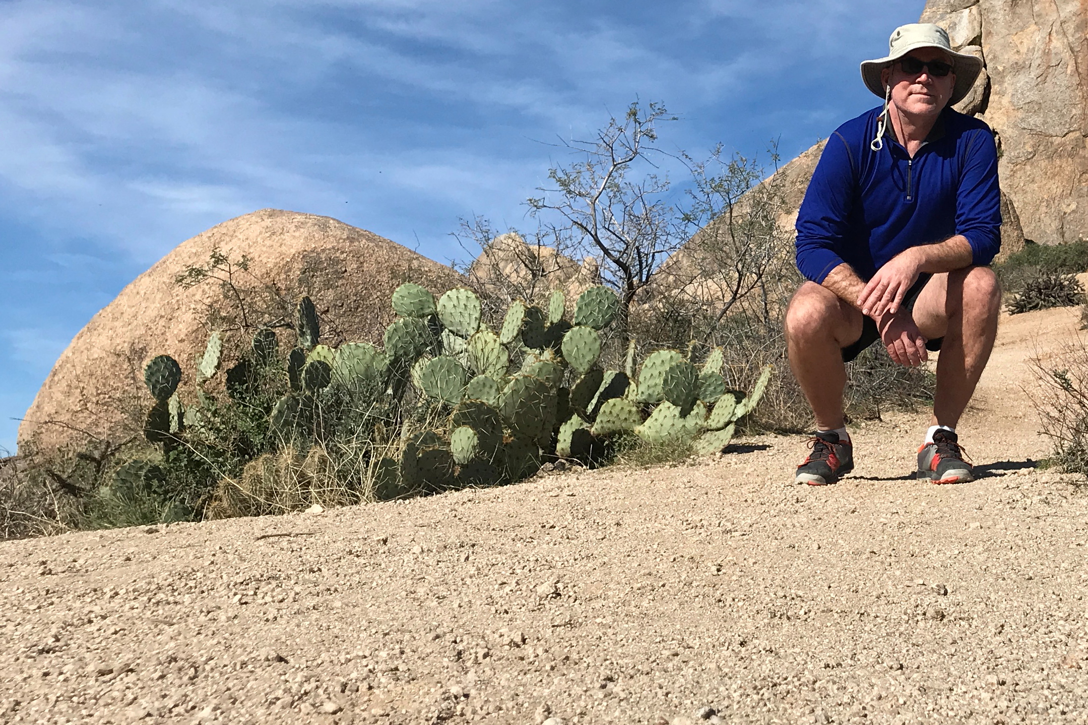
Photo Blogger Doug Weir in McDowell Sonoran Preserve
Hi, I’m Doug Weir. Welcome to my blog!
My blog features nature and landscape photography from the North American wilderness, mostly from Alberta, Arizona, British Columbia, California, Colorado, Minnesota, Washington and Wyoming.
As a nature and landscape photographer, I’m also an avid hiker and paddler, enabling me to bring you vistas from deep in the wilderness, far off the beaten path.
If you are looking for nature and landscape photography for your living and work space, photography that captures the inspiration and grandeur of the North American wilderness, then this blog and my galleries will have something for you.